0440L-SUNDAY OUTLOOK & INFO FROM GARFIELD COUNTY EMERGENCY MGMT-7/5/2020
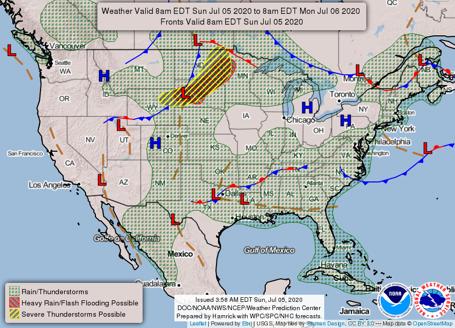
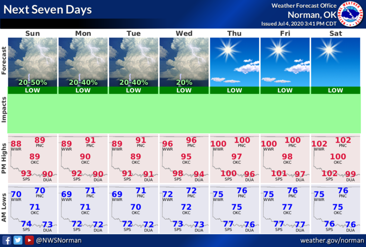
1- We are in a GENERAL THUNDERSTORM RISK area per guidance. If storms occur, the normal threats will be in place. Winds will be the main issue along with torrential rainfall. We’ll see what happens for sure as the day progresses. Here is your forecast from the NWS/NORMAN;
Today- Isolated thunderstorms in the afternoon. Highs in the lower 90s. Light and variable winds becoming east around 10 mph in the afternoon. Chance of thunderstorms 20 percent.
Tonight-Partly cloudy. Lows around 70. East winds around 10 mph in the evening becoming light and variable.
DIRECTORS COMMENT:
As an Emergency Manager for the City and the County, I wanted to thank the majority of everyone for the fireworks displays that were done on PRIVATE PROPERTY. They were very impressive, especially when sitting on a hill with a great view of virtually everything.
As the Fire Chief for Hillsdale-Carrier Fire District, I am very disappointed in many folks that were asked to stop firing off their fireworks on county roads. They would be instructed on what they were doing wrong and were told to clean up the area and move on. They moved on down the road and continued to do their thing. These folks have no idea the cost in loss a farmer would have if fields, (STANDING CROPS) went up in flames. We will be dealing with this for at least another week. Please don’t fire off fireworks on county roads or lease roads. We will be taking tag numbers now as we come across vehicles out in the county. If you are firing fireworks and you start a fire, you just may be footing the bill for the response and the damage you cause.
HAVE A GOOD DAY!!
MIKE