0300L-SUNDAY OUTLOOK FROM GARFIELD COUNTY EMERGENCY MANAGEMENT-6/11/23
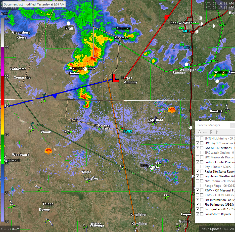
**The radar pic attached is from 0316 this morning**
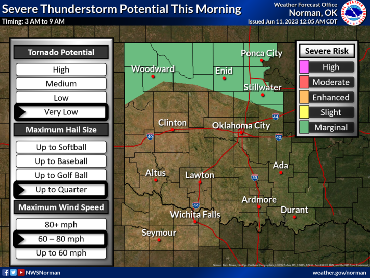
* We are in a MARGINAL RISK for some severe weather this morning as storms enter the state from Kansas. 60 mph winds along with torrential rainfall, and hail are the threats. At 0300L, storms are moving into NE Woods County and soon into Grant County. We’ll see how they track and adjust accordingly. Just expect some wind, rain, and noise this morning. I’ll put a few updates on social media if needed.
*Chances for storms will exist each day this week so we’ll continue to endure the daily possibilities for precipitation. OVERALL, we’ll be ok so just stay up with the latest from us here at EGCEM and the NWS. Here is your SUNDAY forecast from the NWS/NORMAN;
Today- Sunny. Highs in the mid-80s. North winds 10 to 15 mph with gusts up to 25 mph.
Tonight- Mostly clear in the evening, then becoming mostly cloudy. Lows around 60. Northeast winds 10 to 15 mph.
HAVE A GOOD DAY!