0405L-SUNDAY OUTLOOK FROM GARFIELD COUNTY EMERGENCY MANAGEMENT-6/13/21
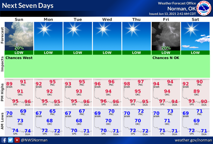
1-We are near a General Thunderstorm Risk area for today. Storms along the Oklahoma/Texas border to our west are weakening. There is an outside chance that storms may reform along boundaries put forth by these storms later today. We shouldn’t see any rain here today. We’ll see what happens.
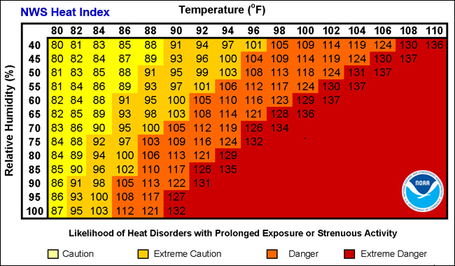
2- High Humidity and Dew Point temps will be the norm for today once again. PACE YOURSELVES while working outdoors. Dewpoint temps and humidity will drop off some this week but we will be hot for this time of the year. High temps will average around the low to mid 90s all week with lows around 70.
3- Overall, we’ll be ok so once again, pace yourselves outdoors and stay hydrated. Here is your forecast from the NWS/NORMAN;
Today-Partly cloudy. Highs in the lower 90s. East winds around 10 mph. Heat Index around 97
Tonight-Clear. Lows in the mid-60s. East winds around 10 mph in the evening becoming light and variable.
Download our GARFIELD COUNTY EM app. It just might save your life!
HAVE A GOOD DAY!
MIKE