FROM GARFIELD COUNTY EMERGENCY MANAGEMENT
ADVISORY IN OUTLINE FORM;
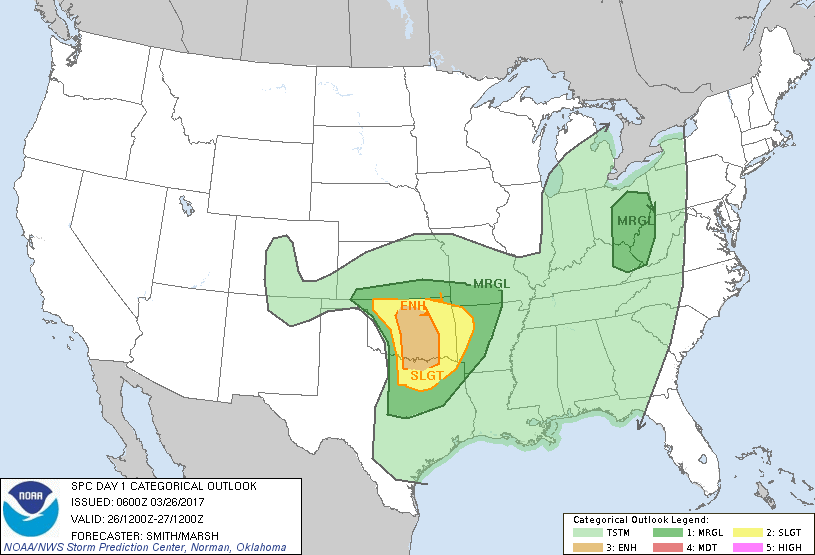
1-We are in an enhanced risk area for severe weather later today
2- Moisture return is questionable as to how far north it will be when the storm system out west arrives. There is a capping inversion over us and it will have to be overcome by the storm system.
3-This system will include a dryline so we’ll see where all of this sets up. Again, a timing issue.
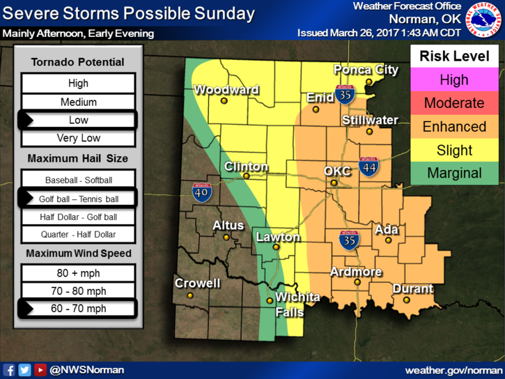
4- Main threats, IF STORMS OCCUR, golf ball size hail, winds 60-70 mph, and a LOW chance for tornadoes. These are our normal thunderstorm forecast parameters. We’ll watch this carefully and update this afternoon.
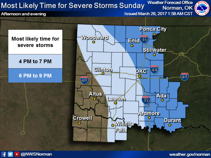
5-Timing for us, as it appears right now at 345 am: 6-9 pm tonight. This may change.
Overall, we do need the moisture so hopefully we’ll see some rainfall. Just make sure things around the house are secure and we’ll see where all this mess sets up. I will update this afternoon so make sure you download our GARFIELD COUNTY EM app.
Here is your forecast from the NWS/NORMAN;
Sunday-50 percent chance of showers and thunderstorms after 1pm. Patchy fog before 7am. Otherwise, partly sunny, with a high near 74. Southeast wind 8 to 18 mph, with gusts as high as 25 mph.
Sunday Night-50 percent chance of showers and thunderstorms. Some of the storms could be severe. Mostly cloudy, with a low around 50. East southeast wind 10 to 14 mph becoming north after midnight. Winds could gust as high as 20 mph.
HAVE A SUPER DAY!
MIKE