0340L-SUNDAY OUTLOOK FROM GARFIELD COUNTY EMERGENCY MANAGEMENT-5/23/21
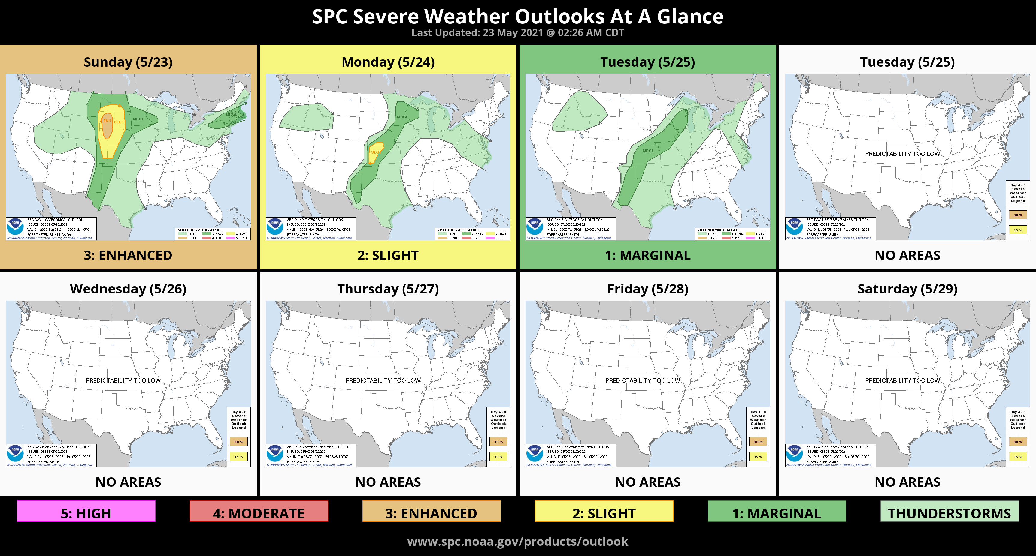
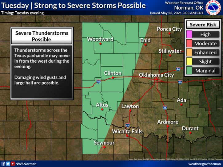
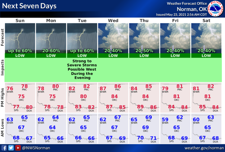
1- GENERAL THUNDERSTORM RISK once again. Per guidance, we can expect another day of showers just about anywhere but we may see them form in the area just west of I-35. We can expect basically the same type of weather through next Friday with a few troughs moving through the region giving us and those folks in the central and northern plains a chance for heavier thunderstorms. First round for heavier weather will be Tuesday and then again on Thursday. We’ll see what happens.
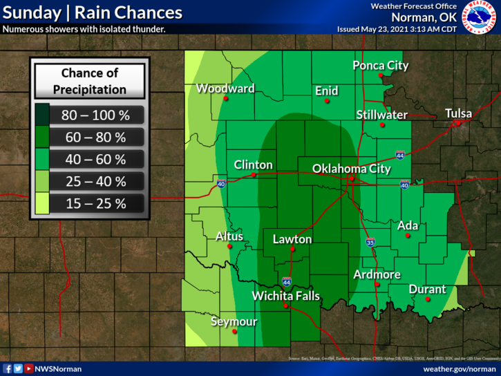
2-Here is your county-wide forecast from the NWS/NORMAN;
Today-Cloudy. Patchy fog in the morning. Showers likely with possible thunderstorms and drizzle in the morning, then a chance of showers and isolated thunderstorms in the afternoon. Highs in the upper 70s. South winds 10 to 15 mph. Chance of precipitation 60 percent.
Tonight-Mostly cloudy. Lows in the lower 60s. South winds 10 to 15 mph.
Finally- Decision-making in stressful situations: If you are uninformed, not ready, in an emotional state, and/or just totally unprepared for life to happen, DO NOT try to make possibly life threatening decisions on your own. Where people go wrong is their mind-set, IT WON’T HAPPEN HERE OR TO ME. Believe me folks, it will and when it does get ready because it may be extreme. At least Think through different situations that could occur and come up with a solution. Will that solution be the right one? It might or might not! More on this is coming to the gcem.org website in the near future.
HAVE A GOOD DAY!!
MIKE