0320L-THURSDAY OUTLOOK FROM GARFIELD COUNTY EMERGENCY MANAGEMENT-4/21/22
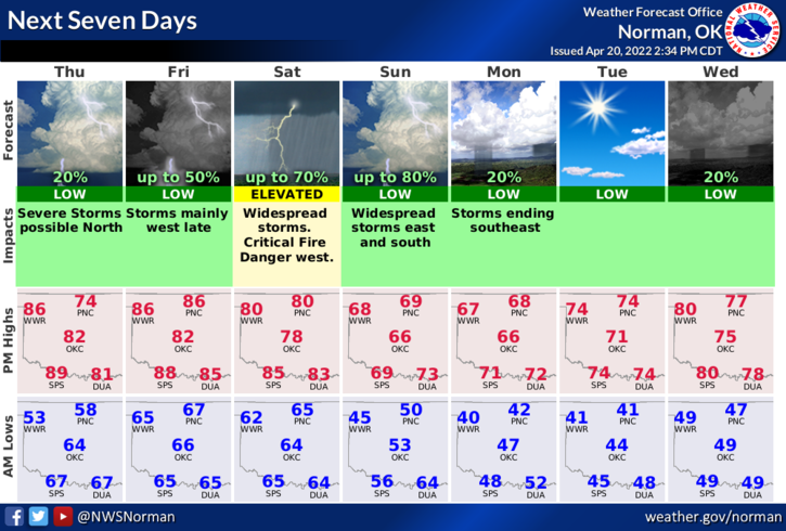
WE WILL FACE A POSSIBLE SEVERE RISK FOR STORMS THROUGH SUNDAY.
1- Here is your forecast from the NWS/NORMAN;
Thursday-Partly sunny with a slight chance of showers and thunderstorms. Highs around 80. Southeast winds 15 to 20 mph with gusts up to 30 mph. Chance of rain 20 percent.
Thursday Night-Partly cloudy and breezy. Lows in the mid-60s. South winds 20 to 25 mph with gusts up to 40 mph.
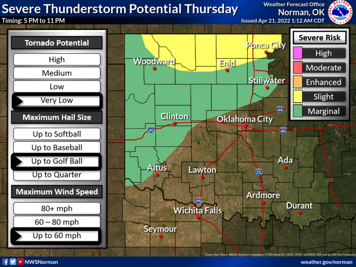
2-SLIGHT RISK for severe weather this evening. Not expecting a widespread event BUT if any updraft can break the capping inversion above us then those cells will become very severe with LARGE HAIL being the main threat but ALL HAZARDS WOULD BE POSSIBLE. A low chance for showers will exist all day if anything can actually get going.
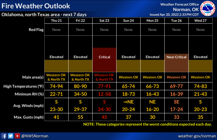
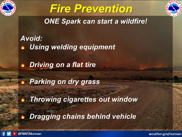
3- Fire Danger is still up there so use extreme caution while utilizing anything related to fire. Winds will be strong today and tonight so we ASK that no controlled burning OCCUR TODAY.
4- Overall, a warm and humid day so pace yourselves while working outdoors and keep an eye to the sky later today and tonight.
HAVE A GOOD DAY!