FROM GARFIELD COUNTY EMERGENCY MANAGEMENT
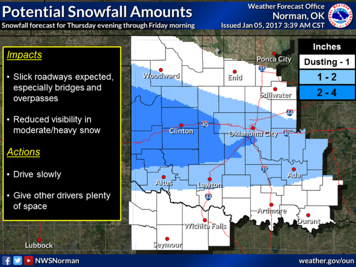
It’s going to get colder and we may see a snow flurry or two starting later tonight and tomorrow. The NWS has issued a Winter Weather Advisory from 10 pm tonight through Friday at noon for counties to our south and southwest. If you plan on traveling in those directions tonight and tomorrow, SLOW DOWN and take your time. We don’t expect any major issues but it doesn’t take long to get into trouble if you don’t pay attention to conditions around you.
For us here in Garfield County and this also goes for our surrounding areas, we may see a dusting of snow, maybe a little heavier depending on the storm track. We are not expecting travel issues here but REMEMBER: USE EXTREME CAUTION ON OVERPASSES AND BRIDGES. They will freeze before the main roads will. We will remain below freezing so keep that in mind too.
School starts back up today so for those of you that like to speed through school zones, keep your eyes peeled for the Police. Speeding in school zones is a hefty fine and in my opinion very deserving if you drive through faster than the speed limit states. Folks are really lucky that I can’t write tickets. Between texting and driving, speeding in school zones and not stopping at stop signs, I could possibly fund my department while losing friends because they made bad decisions. HMMM.
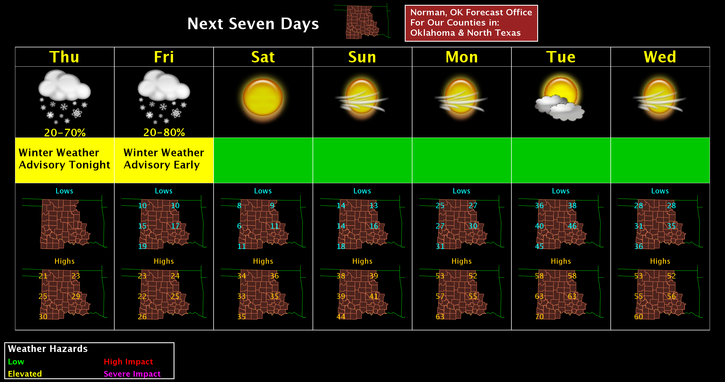
Here is your forecast from the NWS/NORMAN;
Today-Cloudy, with a high near 23. Wind chill values as low as zero. North wind 13 to 17 mph, with gusts as high as 24 mph.
Tonight-30 percent chance of snow after midnight. Cloudy, with a low around 10. Wind chill values as low as -2. North wind 8 to 11 mph. New snow accumulation of less than a half inch possible.
Have a super day and stay warm.
MIKE