0400L-THURSDAY OUTLOOK FROM GARFIELD COUNTY EMERGENCY MANAGEMENT-6/10/21
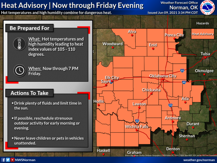
HEAT ADVISORY IN EFFECT UNTIL FRIDAY EVENING AT 7PM
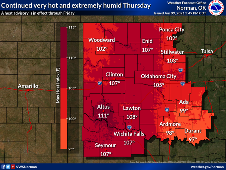
1- As stated last week, very humid weather would follow the cool weather. We seem to go from one extreme to another. That’s Oklahoma for you. With our dew point temps in the 70s and humidity in the 50s and 60s, very uncomfortable conditions exist. We have been spoiled by cooler temps during the winter and spring and now we go to the extreme in the heat. We will only be in the mid-90s for high temps but the heat index is what the main issue will be for the next couple of days.
2-Use EXTREME CAUTION while working outside and stay hydrated. There has been several calls for heat exhaustion out there so as stated, pace yourself outdoors and drink plenty of water and use supplements that replace what you lose by sweating. Here is the heat info at the NWS website- https://www.weather.gov/safety/heat
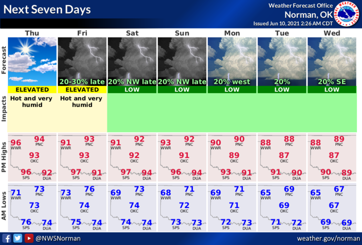
3-A front will push into the area Friday evening dropping the temps a little but not taking away the higher dew point temps and humidity. Winds will become northerly but won’t help too much either. The main thing is PAY ATTENTION TO HOW YOU ARE FEELING and be careful out there.
4- Here is your forecast from the NWS/NORMAN;
Thursday-Mostly sunny with a high near 95. Heat index values as high as 106. Southeast wind 5 to 15 mph.
Thursday Night-Mostly clear with a low around 75. South southeast wind 10 to 15 mph, with gusts as high as 20 mph.
HAVE A GOOD DAY AND STAY COOL
MIKE