0315L-THURSDAY OUTLOOK FROM GARFIELD COUNTY EMERGENCY MANAGEMENT-6/15/23
*Be sure to download our GARFIELD COUNTY EM app. You’re NOT PREPARED without it AND YOU WILL NEED IT OVER THE NEXT SEVERAL DAYS!
** A Significant Severe Weather Event Expected Today Across Parts of the Southern and Central Plains. Here is a link to the STORM PREDICTION CENTER ON TODAY’S DAY 1 OUTLOOK. https://www.spc.noaa.gov/products/outlook/archive/2023/day1otlk_20230615_1200.html
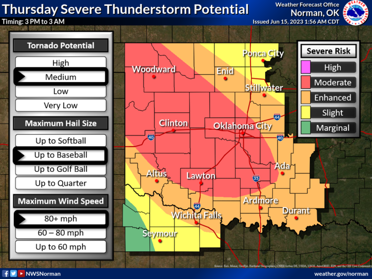
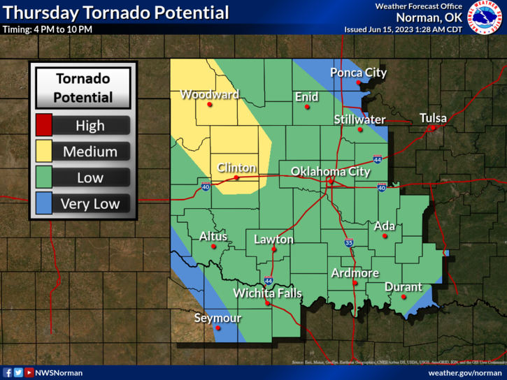
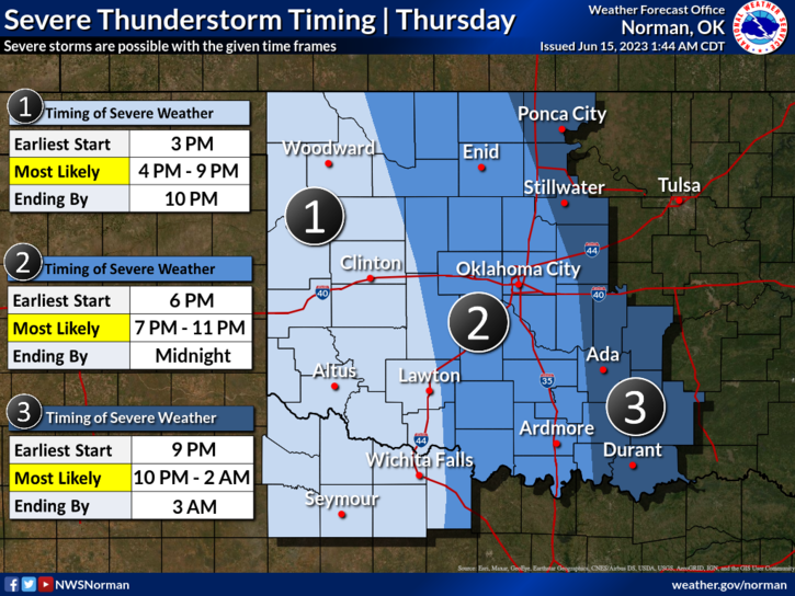
* We are in an Enhanced and Moderate Risk for severe weather today. Baseball size hail and winds in excess of 70 mph are possible & are the main threats. Tornado activity is not out of the question today either. We have a front, a dryline, very unstable atmosphere, the moisture needed, and storm system out west that will be determining what happens and where. Look at the attached graphics but don’t get fixated on where the lines are as they will be adjusted throughout the forecast period. STAY EXTREMELY WEATHER AWARE TODAY.
*Overall, we’ll be ok, possibly just a little shaken. Here is your forecast from the NWS/NORMAN;
Today- Sunny. Highs around 90. Southeast winds around 5 mph, increasing to around 10 mph with gusts up to 20 mph this afternoon.
Tonight- Mostly cloudy with scattered showers and thunderstorms. Lows in the lower 60s. Southeast winds 10 to 15 mph with gusts up to 25 mph. Chance of rain 50 percent.
Finally, make sure you have your severe weather plan in place today BEFORE ANY STORM HITS THE AREA. Making decisions under extreme stress isn’t a good idea.
We’ll advise as needed and GARFIELD COUNTY SPOTTERS WILL BE PLACED ON STANDBY THIS MORNING.
HAVE A GOOD DAY!