0330L-WEDNESDAY OUTLOOK FROM GARFIELD COUNTY EMERGENCY MANAGEMENT-6/14/23
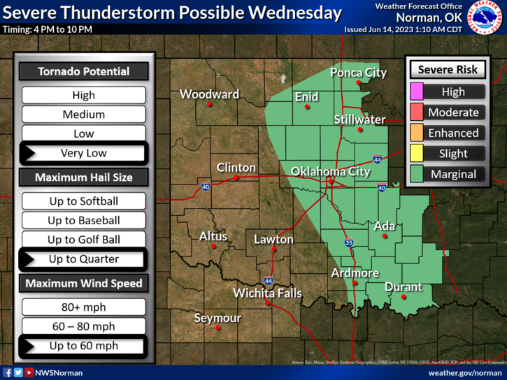
*We are in a MARGINAL RISK for severe weather this afternoon and evening. Our storms, IF they occur, will again come from the high plains of Colorado and western Kansas and depending on where they actually form will determine their track then they will move east/southeast through southern Kansas and possibly into NW and NC OKLAHOMA. Hail and winds will be the main threats.
*Overall, for today, we’ll be ok so here is your forecast from the NWS/NORMAN;
Today- Mostly sunny with isolated showers and thunderstorms. Highs in the mid-80s. Northwest winds around 5 mph, becoming south this afternoon. Chance of rain 20 percent.
Tonight- Partly cloudy in the evening, then becoming mostly clear. Lows in the lower 60s. East winds 5 to 10 mph, becoming southeast after midnight.
*ON THURSDAY, as of right now, we’ll be in a SLIGHT RISK for severe weather with larger hail and higher winds as the main threats. We’ll see how this plays out in later guidance.
*Be sure to download our GARFIELD COUNTY EM app. You’re NOT PREPARED without it.
HAVE A GOOD DAY!