0350L-THURSDAY OUTLOOK AND INFO FROM GARFIELD COUNTY EMERGENCY MANAGEMENT-3/7/19
1- I’ll start out with your forecast from the NWS/NORMAN;
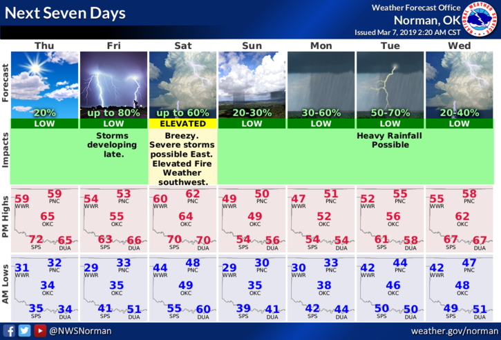
Thursday- Mostly sunny with a high near 59. South wind 5 to 15 mph becoming north in the afternoon. Winds could gust as high as 20 mph.
Thursday Night-Mostly cloudy with a low around 29. North winds 5 to 10 mph.
2- We have a cold front that will move through later today that will bring temps down a little. Nothing dramatic but winds will become northerly.
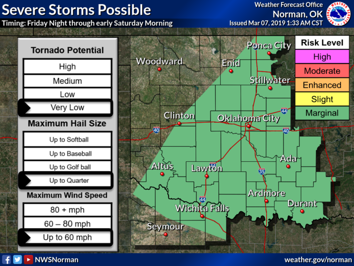
3- FRIDAY evening we’ll see a chance for thunderstorms. Our category is MARGINAL. The first graphic attached is for FRIDAY EVENING THRU SATURDAY MORNING. This graphic WILL change some between now and then. NO PANIC necessary at this time. Take the time to READ the info on the graphics. The edges of the colored portions on the graphic will change some over time so keep that in mind too.
4- Overall, we’ll be ok here, so just stay weather aware and if you plan on traveling east or southeast this weekend, make sure you keep up with the latest information along your route and at your destination.
HAVE A GREAT DAY!
MIKE