0425L-WEDNESDAY OUTLOOK FROM ENID/GARFIELD COUNTY EMERGENCY MANAGEMENT-5/16/18
1-30% CHANCE FOR RAIN BUT THE SEVERE WEATHER THREAT IS LOW. RIGHT NOW AT 0415 LOCAL TIME SOME SMALL THUNDERSTORMS ARE CENTERED IN THE WAUKOMIS AREA MOVING ENE. HEAVY RAINFALL, LIGHTNING, AND A LITTLE NOISE MAY ACCOMPANY THESE CELLS. We will experience some scattered rainfall this morning.
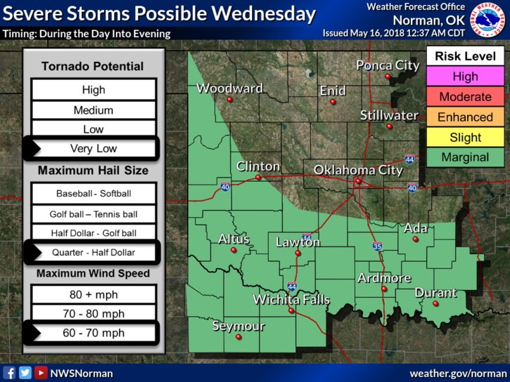
2- The threat for severe weather later today and tonight looks to be to our west and southwest. If you plan on traveling, keep the forecast in that area in mind.
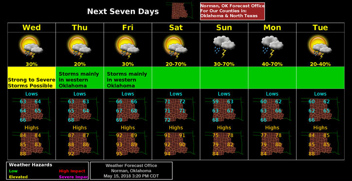
3- Overall, a nice day. Here is your forecast from the NWS/NORMAN;
Wednesday-30 percent chance of showers and thunderstorms. Some of the storms could produce heavy rainfall. Partly sunny, with a high near 84. Light and variable wind becoming east 5 to 8 mph in the morning.
Wednesday Night-20 percent chance of showers and thunderstorms. Partly cloudy, with a low around 63. East wind 5 to 8 mph.
4-Be sure to download our GARFIELD COUNTY EM app. HAVE A SUPER DAY!!
MIKE