0358L-WEDNESDAY OUTLOOK FROM GARFIELD COUNTY EMERGENCY MANAGEMENT-5/22/19
1- FLOOD WARNING IN EFFECT UNTIL 1:15PM THIS AFTERNOON. USE EXTREME CAUTION WHILE DRIVING. Don’t drive around barricades. Main highways in Garfield County are open. Some secondary roads may be closed. Driving down many dirt roads is not advised.
2- Our app GARFIELD COUNTY EM = “LOCAL” EMERGENCY INFORMATION & PUSH NOTIFICATIONS FROM THE NWS.
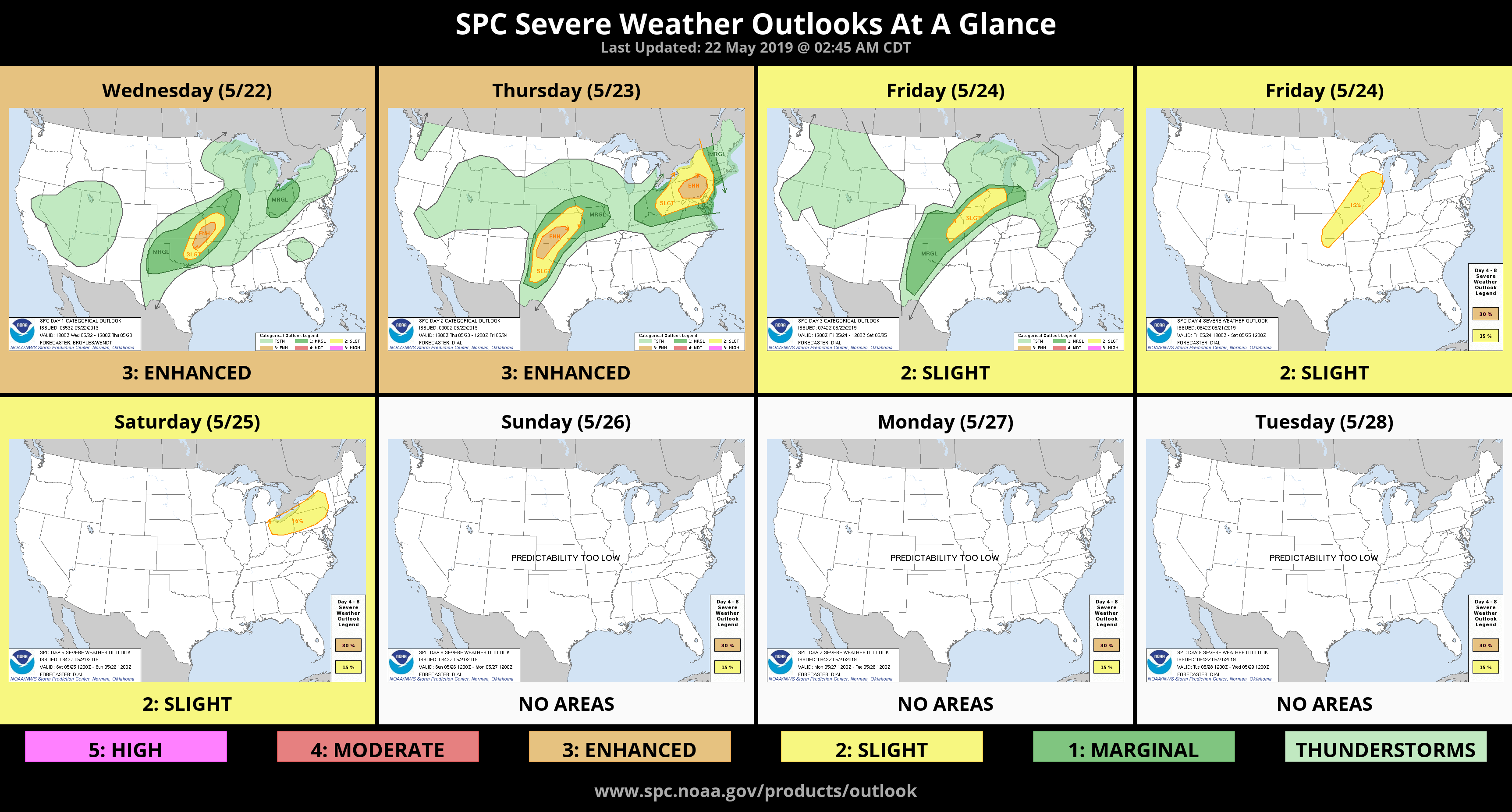
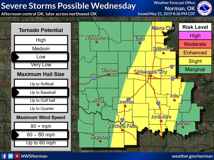
3- We are in a SLIGHT RISK for severe weather later today. All risks are possible if parameters come together. Timing for us, late afternoon but most likely during the evening hours and overnight. This may change so we’ll advise as needed.
4- For those who lose TV with cable or satellite during storms, consider getting an HD-ANTENNA and you’ll have TV during storms. They aren’t expensive and this is the way we watched TV growing up. We were in heaven watching 4 stations!! Now, you can pick up about 30-40 digital stations. In some cases, you may be able to install that antenna inside your attic. SEE!! A free preparedness tip.
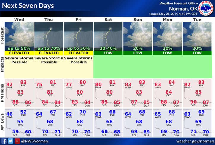
5- Here is your forecast from the NWS/NORMAN;
Wednesday-Mostly sunny. A slight chance of thunderstorms in the afternoon. Warmer. Highs in the mid 80s. South winds 10 to 15 mph. Chance of thunderstorms 20 percent.
Wednesday Night-Partly cloudy. A chance of thunderstorms in the evening, then a slight chance of thunderstorms after midnight. Warmer. Lows in the upper 60s. South winds around 10 mph. Chance of thunderstorms 40 percent.
HAVE A GREAT DAY!!
MIKE