0357L-THURSDAY OUTLOOK FROM GARFIELD COUNTY EMERGENCY MANAGEMENT-5/5/22
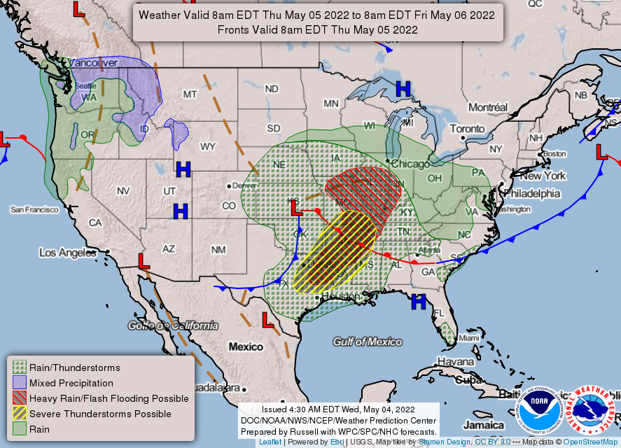
1- Clouds, rain, and cool temps are expected through the day until the mid-level trough moves out of the Texas Panhandle into the central plains. That should happen by tomorrow. No severe weather is expected here in our area today.
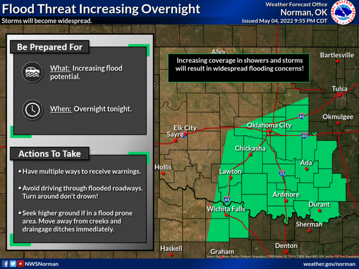
2- Flooding is taking place in several areas to our south, southeast, and a few areas southwest. IF YOU PLAN on traveling, check road conditions along your route. You can find that info on our gcem.org website about mid-way down the front page under Current Road Conditions.
3- Overall, a few thunderstorms from now through the morning hours.
4- HERE IS YOUR FORECAST FROM THE NWS/NORMAN;
Today-Mostly cloudy with a chance of thunderstorms. Showers likely, mainly this morning. Some thunderstorms may produce heavy rainfall. Highs in the mid 60s. Northwest winds 10 to 15 mph. Chance of rain 70 percent.
Tonight-Partly cloudy in the evening, then becoming mostly clear. Lows in the mid 40s. Northwest winds 10 to 15 mph.
HAVE A GOOD DAY!