0415L-WEDNESDAY OUTLOOK FROM GARFIELD COUNTY EMERGENCY MANAGEMENT-5/4/22
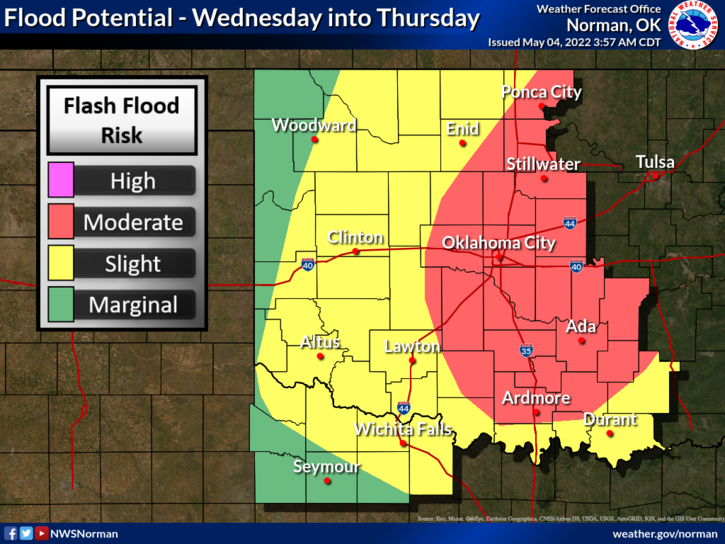
1-FLOOD WATCH through central Oklahoma from 0600 this morning until noon on Thursday.
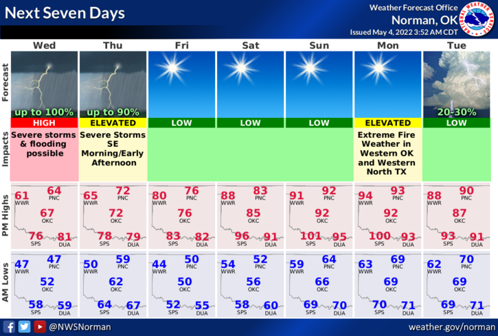
2-Here is your forecast from the NWS/NORMAN;
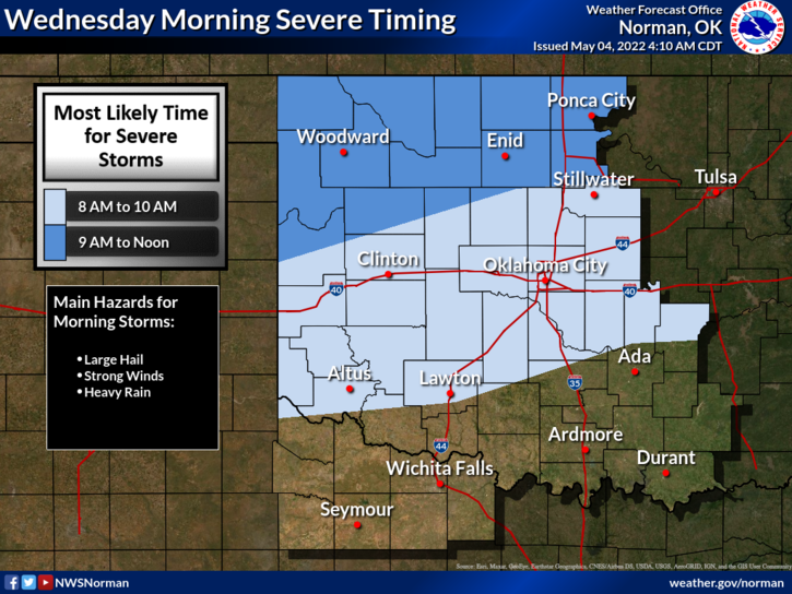
Today-Showers, thunderstorms. Some thunderstorms may be severe this afternoon. Highs in the lower 60s. East winds 5 to 10 mph. Chance of rain 80 percent.
Tonight-Thunderstorms, showers. Near steady temperature in the lower 60s. Northeast winds 10 to 15 mph. Chance of rain 90 percent.
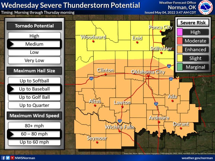
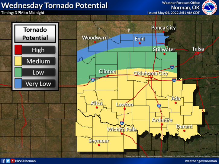
3- At the time of this outlook, we are in a SLIGHT RISK for severe weather possibly this morning and again this afternoon into the overnight hours. The highest risk is in the southern half of the state but if conditions are just right, any hazard can occur. We’ll watch this carefully once again.
4- Overall, we’ll be ok but stay prepared and work on your preparedness plans. You never know when you might need them.
5- GARFIELD COUNTY EM. This is our emergency app. If you don’t have it, you will need it at some point. It’s a great product to have in the process of being prepared.
HAVE A GOOD DAY.