0305L-THURSDAY OUTLOOK FROM GARFIELD COUNTY EMERGENCY MANAGEMENT-10/14/21
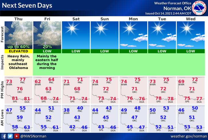
1- A nice day for today with temps in the 70s. There is ANOTHER COLD FRONT that will be moving our way bringing a chance for thunderstorms along the front this evening and overnight. Per guidance, since we’ll have sufficient instability, large hail will be the main threat with this front as it moves into the area.
2- After frontal passage, temps will drop below average and highs on Friday will be in the 60s. The weekend looks cool and we should remain around average temp-wise through mid-week when another front affects the area. Overall, we are slowly transitioning to cooler temps so enjoy before we do get colder. It would be a good idea to continue to work on your preparedness plan for any type of severe weather we could have the rest of this fall and winter.
3- Here is your forecast from the NWS/NORMAN;
Thursday-Partly cloudy. Highs in the upper 70s. South winds around 10 mph.
Thursday Night-Partly cloudy with a chance of thunderstorms. Lows in the upper 40s. East winds around 10 mph shifting to the north after midnight. Chance of thunderstorms 50 percent.
Be sure and download our GARFIELD COUNTY EM app. Learn what it can teach you and do for you.
STAY SAFE
MIKE