0305L-THURSDAY OUTLOOK FROM GARFIELD COUNTY EMERGENCY MANAGEMENT-9/22/2022
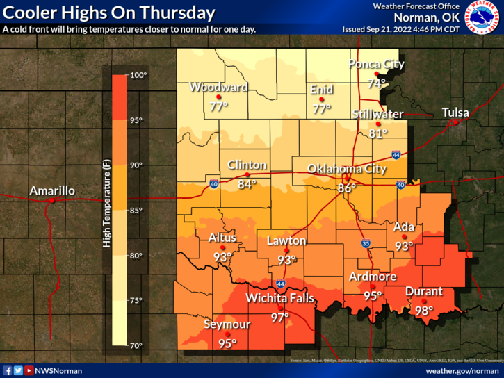
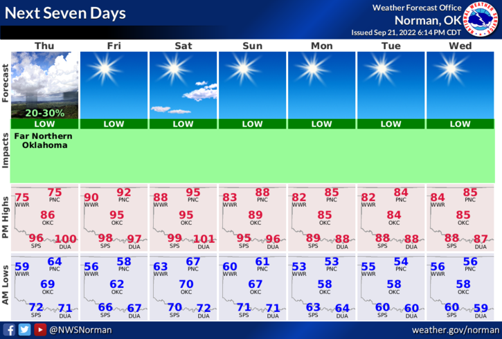
1- Heat is history for today as highs will be in the 70s but rest assured that temps will be back in the 90s for Friday and maybe Saturday. Beginning Sunday, we’ll see mostly 80s for highs as the pattern changes a little bit. Overnight lows for the next 7 days will average from the mid-50s to mid-60’s. Looks like we may be seeing the beginning of Fall temps. We’ll see what happens.
2- Keep an eye out for suspicious activity out there and report it immediately. If you see smoke or fire, call 911 so the proper response can be dispatched. We are still in a severe to exceptional drought so use “extreme caution” if utilizing anything related to fire. Controlled burning right now is NOT a good idea.
3- OVERALL, we’ll be ok and there is an outside chance we could see a shower somewhere in our area this morning so don’t be surprised if a few raindrops occur. Here is your forecast from the NWS/NORMAN;
Today-Partly sunny. Much cooler with highs in the mid-70s. Northeast winds 10 to 15 mph with gusts up to 25 mph.
Tonight-Mostly clear. Lows in the mid-50s. Northeast winds 5 to 10 mph.
HAVE A GOOD DAY!!