0420L-TUESDAY OUTLOOK & INFO FROM GARFIELD COUNTY EMERGENCY MGMT-4/21/2020
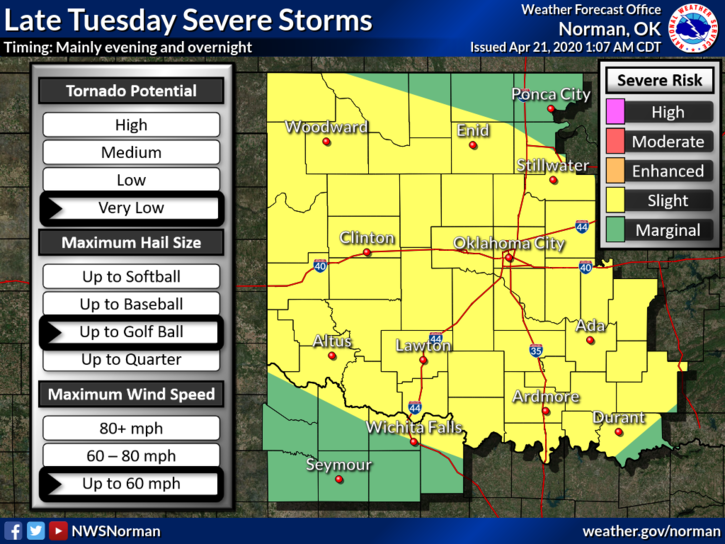
1- We are in a SLIGHT RISK area for severe weather later today into the evening and overnight hours. The main threats look to be golf ball size hail and winds to 60 mph or so. See attached graphic. NOTE- the graphics will change a few times during the day. We’ll advise as needed.
2- Remember that you can get all NWS Advisories and Warnings along with our local information from us here at GCEM through our GARFIELD COUNTY EM app. It’s free so be informed at all times and download our app today.
3- Here is your forecast from the NWS/NORMAN;
Today-Partly cloudy. Highs in the upper 70s. Light and variable winds becoming southeast around 10 mph in the afternoon.
Tonight-Thunderstorms likely in the evening, then thunderstorms after midnight. Some thunderstorms may be severe with large hail. Lows in the mid-50s. East winds around 10 mph.
No Directors Comment today.
HAVE A SUPER DAY!!
MIKE