0400L-WEDNESDAY OUTLOOK & INFO FROM GARFIELD COUNTY EMERGENCY MGMT-2/22/2020
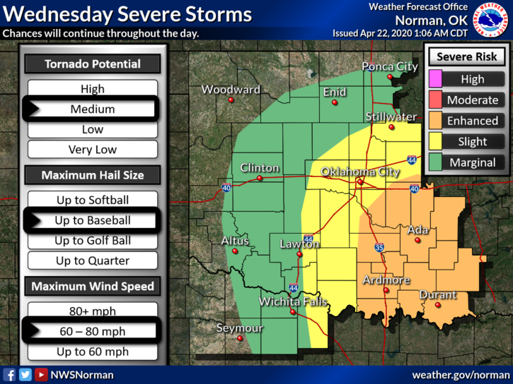
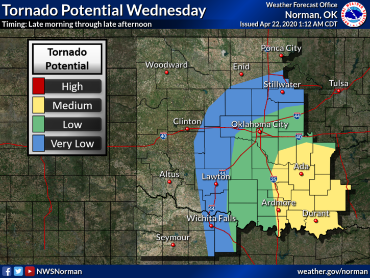
1-We are in a MARGINAL RISK AREA for possibly some severe weather today. If severe weather occurs, quarter size hail and winds to 65mph are possible through our area. The main storm system that is causing all of this mess in the Texas Panhandle and in southern Oklahoma will push through during the day. We actually have a better chance for showers and thunderstorms this morning so we’ll see if we can get some rain. Overall, we’ll be ok and we’ll watch and advise as needed.
2-GARFIELD COUNTY EM. This is our notification app. YOU are NOT PREPARED if you don’t have this app in Garfield County. NWS warnings/advisories, etc. automatically push through our app along with information from the Sheriff, EPD, and GCEM.
3- Here is your forecast from the NWS/NORMAN;
Today-Thunderstorms in the morning, then thunderstorms likely in the afternoon. Cooler. Highs in the upper 60s. Southeast winds 10 to 15 mph shifting to the northeast 10 to 20 mph in the afternoon.
Tonight-Partly cloudy. A chance of thunderstorms in the evening. Lows in the upper 40s. Northwest winds 10 to 15 mph. Chance of thunderstorms 50 percent.
HAVE A GREAT DAY!!
MIKE