0355L-TUESDAY OUTLOOK & INFO FROM GARFIELD COUNTY EMERGENCY MANAGEMENT-2/26/19
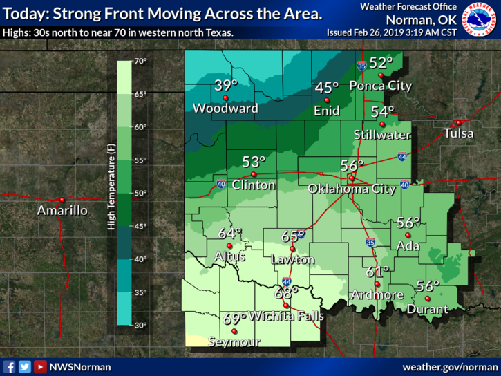
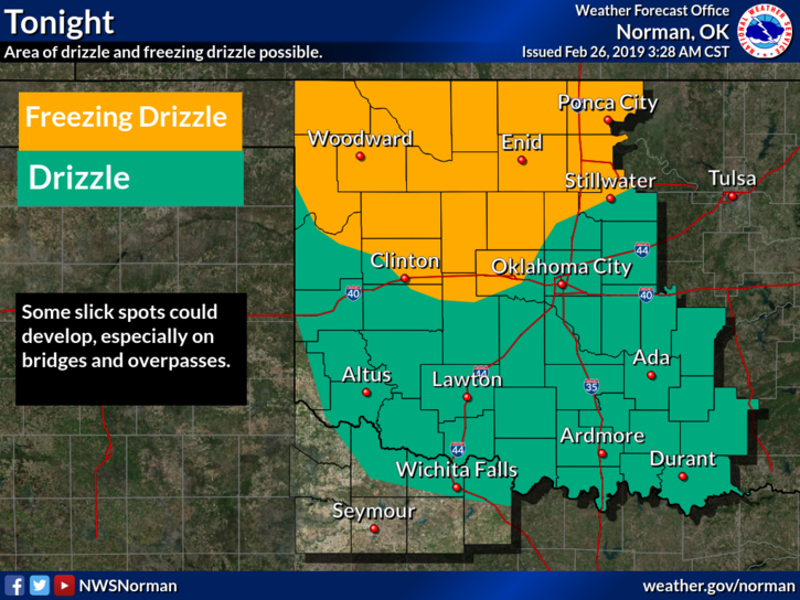
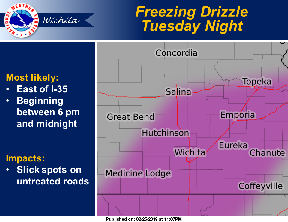
1) A cold front is lurking on our front door so highs today could be a bit tricky. It will depend where it ends up. Winds will be northerly so get ready for some cooler or I should say COLDER air. Freezing drizzle is possible late tonight and tomorrow so plan accordingly. Nothing is expected to shut everything down BUT be prepared just in case.
2) GARFIELD COUNTY EM if you don’t have this app, you’re NOT PREPARED! I’ll send relevant information as it relates to the event. Understand that you don’t need minute by minute information. Weather happens, enjoy it, understand it, and respect it. You’ll be ok.
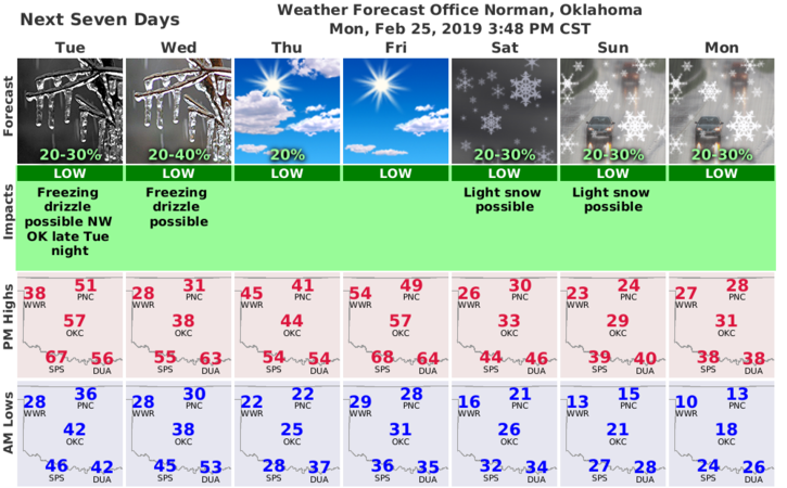
3) Here is your forecast from the NWS/NORMAN;
Tuesday- Partly sunny with a high near 44. North-northwest wind 5 to 10 mph becoming light and variable in the afternoon.
Tuesday Night-A slight chance of drizzle before midnight, then a slight chance of drizzle or freezing drizzle. Mostly cloudy with a low around 29. Light north wind increasing to 10 to 15 mph in the evening. Winds could gust as high as 21 mph.
HAVE A GOOD DAY!!
MIKE