0355L-TUESDAY OUTLOOK & INFO FROM GARFIELD COUNTY EMERGENCY MGMT-7/7/2020
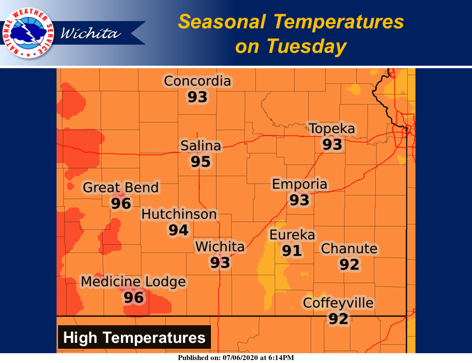
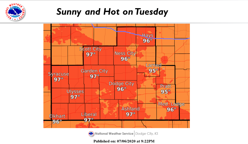
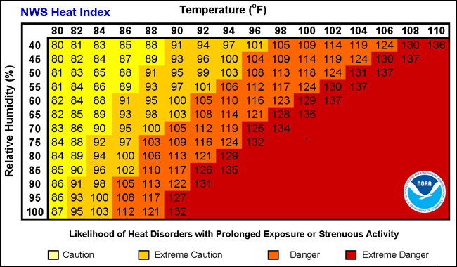
1-Sunny and warm with light winds once again today. Mostly dry conditions again too. Rain chances will increase for the area Thursday and Friday. Dangerous heat index conditions will exist late in the week and over the weekend as we will hit 100+ degrees with heat index temps around 110 degrees. BE PREPARED for these conditions. I am adding graphics from the Wichita and Dodge City NWS offices today too.
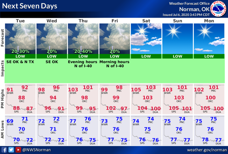
2-Here is your forecast from the NWS/NORMAN;
Tuesday-Mostly sunny with highs in the mid-90s. Southeast winds up to 10 mph.
Tuesday Night-Clear with lows around 70. Southeast winds around 10 mph.
DIRECTORS COMMENT
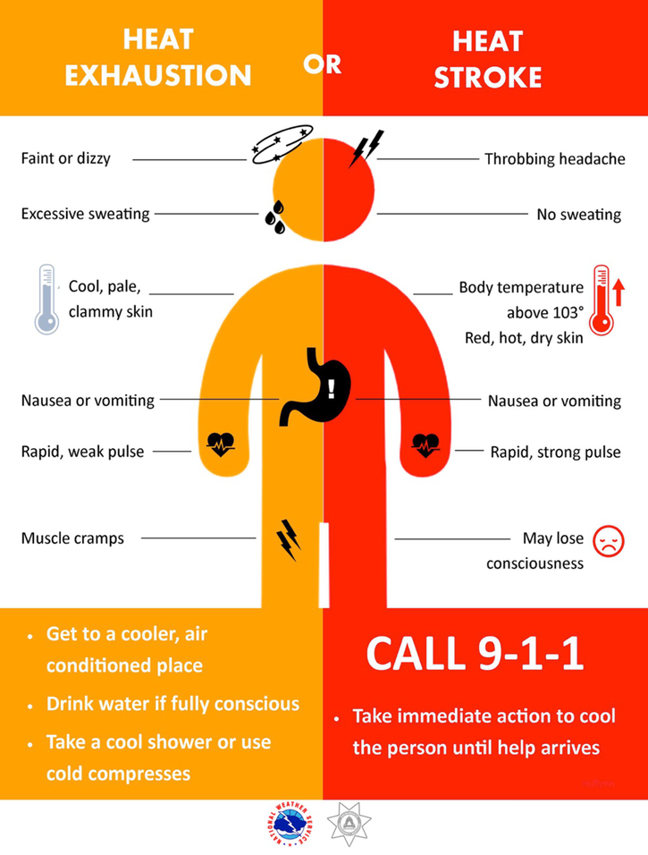
As summer continues, most folks don’t really think much about the heat until they start to feel weak and or they collapse. At this point, your life could be in imminent danger. The best way to limit that threat is to pay VERY CLOSE ATTENTION to how you feel while outside. If you are sweating a lot, that’s a good thing. If you notice that you have stopped sweating, that is a DANGER sign and you need to stop immediately and start re-hydrating yourself with WATER. Hydration products sometimes contain large amounts of sugar which isn’t good for you. The main thing you need to know is YOUR OWN BODY and how it handles the heat.
If you have had even the low end HEAT EXHAUSTION, you will be more susceptible to heat issues so once again, PACE YOURSELF and pay attention to how you are feeling. Your LIFE DEPENDS ON IT.
HAVE A GOOD DAY!!
MIKE