0310L-TUESDAY OUTLOOK FROM GARFIELD COUNTY EMERGENCY MANAGEMENT-6/13/23
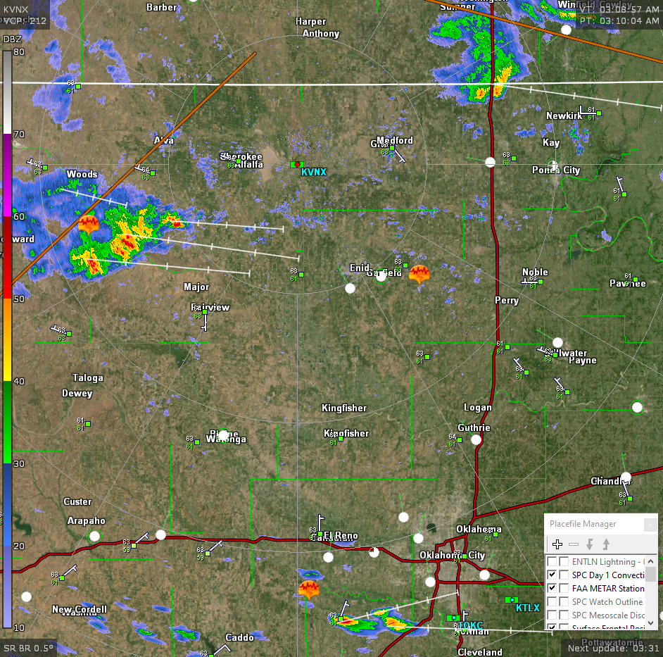
* We are in another GENERAL RISK area for thunderstorms again today. Right now at 0310L, there are a few thunderstorms in the Quinlan to Carmen area. These are moving east at around 30 mph. Heavy rain is the main issue with these right now. The bigger severe threat will be in North Texas and Southern Oklahoma again today so if you plan on traveling, pay close attention to the weather. The threats with the southern tier storms will be golfball size hail and torrential rainfall with some rainfall rates of 1-2 inches per hour.
*For our region in northern Oklahoma, thunderstorms are moving east at 30 mph and they look to affect the southern Grant and northern half of Garfield County within the next hour or so. Expect a little noise, gusty winds, and torrential rainfall. Overall, we’ll be ok. Here is your forecast from the NWS/NORMAN;
Today- Partly sunny. A slight chance of showers and thunderstorms this morning. Highs around 80. East winds around 5 mph. Chance of rain 20 percent.
Tonight- Mostly cloudy with a chance of showers and thunderstorms in the evening, then partly cloudy with a slight chance of showers and thunderstorms after midnight. Lows around 60. Southeast winds around 5 mph, becoming southwest after midnight. Chance of rain 30 percent.
*Be sure to download our GARFIELD COUNTY EM app. You’re NOT PREPARED without it.
HAVE A GOOD DAY!