0340L-TUESDAY OUTLOOK FROM GARFIELD COUNTY EMERGENCY MANAGEMENT-6/15/21
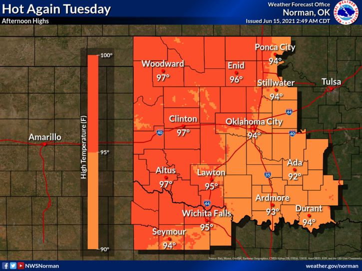
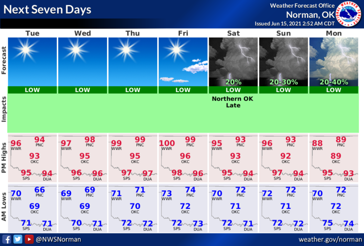
1- Heat, lower humidity, and light winds are what we’ll deal under sunny skies today. It appears we will become very toasty Wednesday and Thursday due to a thermal ridge that will increase temps at or near 100 degrees. A cold front is forecast to enter the area and it MIGHT bring some rain activity. We’ll have to wait and see if this actually happens. Models also state that a tropical system may develop in the northern gulf so an eye will be kept down there too. It most likely will not affect us right now. Here is your forecast from the NWS/NORMAN;
Today-Sunny. Highs in the upper 90s. Light and variable winds becoming southeast around 10 mph in the afternoon.
Tonight-Clear. Lows in the upper 60s. Southeast winds around 10 mph in the evening becoming light and variable.
2- Harvest is in full swing right now so be careful on the roads and please be patient with those moving farm equipment. Also, when driving on county roads, SLOW DOWN AT EVERY INTERSECTION. Most are not marked with a sign so use extreme caution and remember to yield the RIGHT of way if other vehicles are approaching at the same time. Horrific accidents can occur at intersections and on roads that may not be really smooth. Just be careful.
3-Be sure to download our GARFIELD COUNTY EM app. It just might save your life!
4- We are updating our HAZARD MITIGATION PLAN. Because we aren’t holding many meetings right now, we have been approved to have questions answered by survey. The following link is safe and will take you to a 17 question survey. If you live in GARFIELD COUNTY and would answer these question, it would be greatly appreciated. Here is the link and it will take you maybe 2 minutes to answer these questions. Here is the link- https://www.surveymonkey.com/r/5CRNY9J
HAVE A GOOD DAY!!
MIKE