0415L-TUESDAY UPDATE FROM ENID/GARFIELD COUNTY EMERGENCY MANAGEMENT-6/19/18
1-THE HEAT IS STILL ON. HIGH AROUND 91 WITH A HEAT INDEX IN THE MID TO UPPER 90’S.
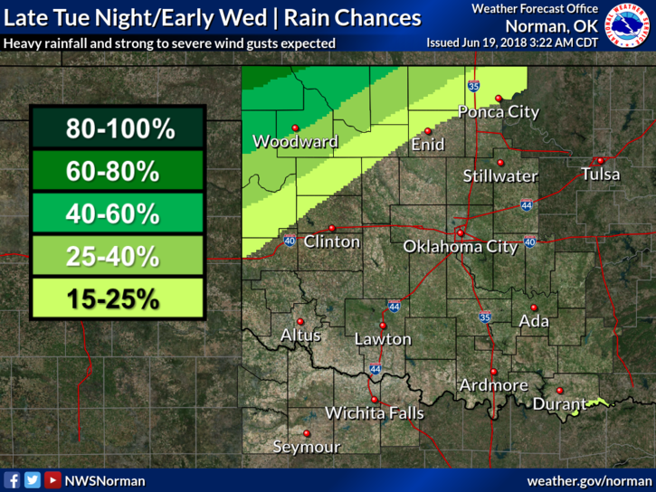
2- Rain chances are going up for us later tonight into Wednesday and Wednesday night. There is an outside chance for a stray storm tonight but don’t hold your breath. Just continue to enjoy the heat as winter will be coming in just about 4-5 months.
3- Remember to stay hydrated while working outside. If you are prone to headaches while working outdoors, you may have a heat related illness and don’t know it. If this is happening, see your doctor so you can be treated. Putting this off can cause major issues for you. Heat related illnesses are NOT a joke. Get treated and pace yourself while outdoors.
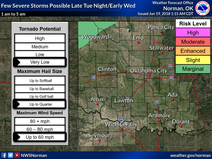
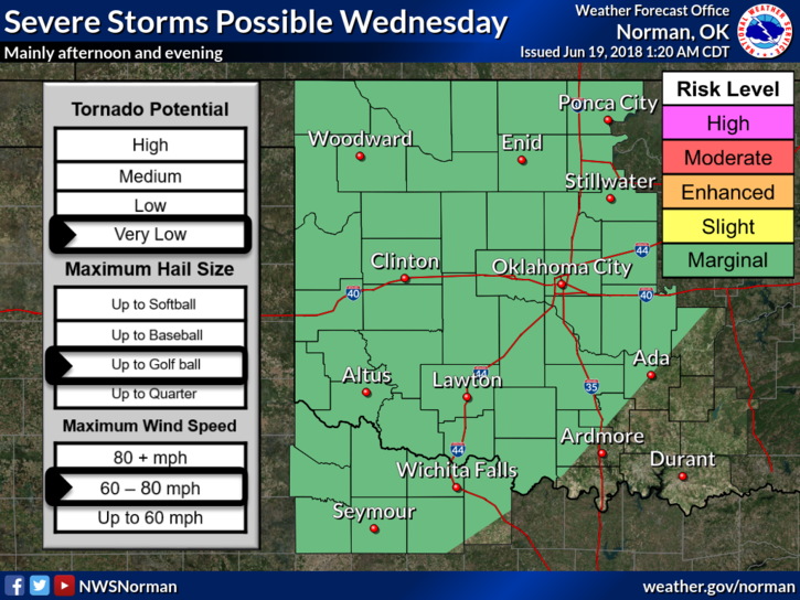
3-We will be under a MARGINAL risk for some severe weather on Wednesday. Hail and damaging winds will be the main threats along with torrential rainfall if you end up underneath one of these cells. Nothing to worry about right now unless you live in a flood prone area. Make sure you have a plan just in case. The forecast will change some over time so we’ll keep you up to date.
4- Here is your forecast from the NWS/NORMAN;
Tuesday-Mostly sunny, with a high near 91. South wind 10 to 14 mph, with gusts as high as 20 mph.
Tuesday Night-20 percent chance of showers and thunderstorms after 1am. Partly cloudy, with a low around 72. South southeast wind 10 to 15 mph, with gusts as high as 21 mph.
HAVE A SUPER DAY!!
MIKE