0430L-WEDNESDAY UPDATE FROM ENID/GARFIELD COUNTY EMERGENCY MANAGEMENT-6/20/18
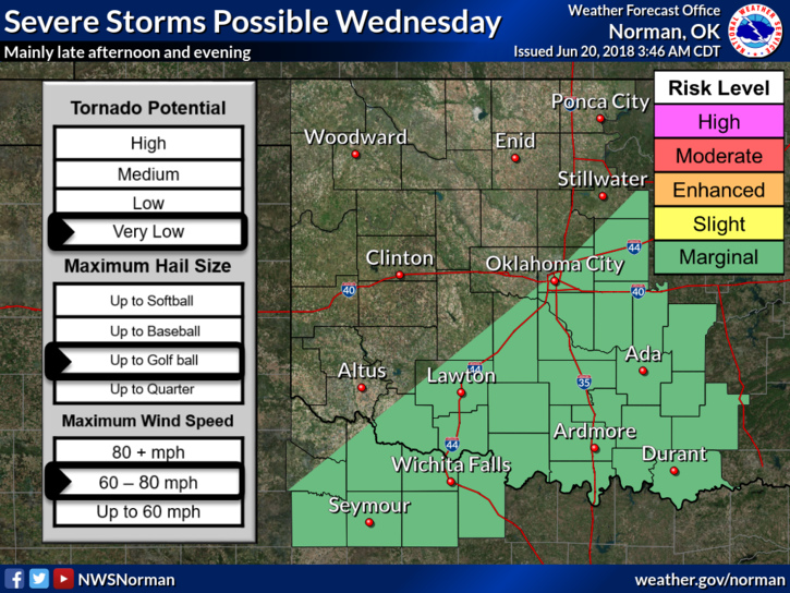
1- We are in a GENERAL RISK for severe weather today. The Meso Convective System affecting us right now and for a while this morning will continue ESE and weaken per guidance. The higher risk for severe weather will be ESE of here today. See graph. Our next risk for severe weather comes in on Friday. We’ll see what happens.
2- Overall, we’ll be ok. Enjoy the rain.
3-Here is your forecast from the NWS/NORMAN;
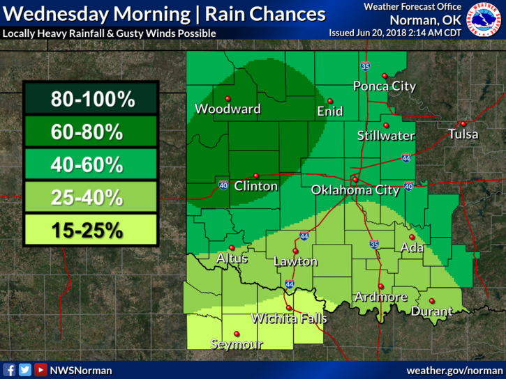
Wednesday-Showers and thunderstorms likely, mainly between 7am and 10am. Partly sunny, with a high near 88. Light and variable wind becoming south southwest 6 to 11 mph in the morning. Chance of precipitation is 60%. New rainfall amounts between a tenth and quarter of an inch, except higher amounts possible in thunderstorms.
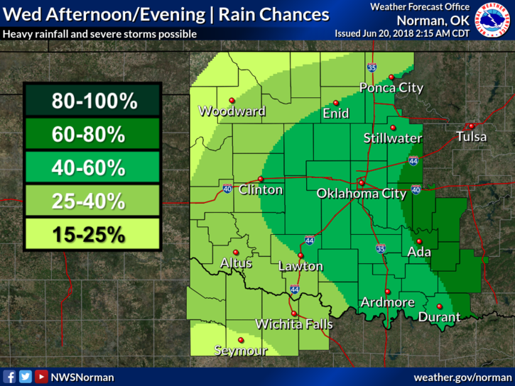
Wednesday Night-20 percent chance of showers and thunderstorms before 1am. Partly cloudy, with a low around 67. North northwest wind 3 to 8 mph.
Finally, Thank you for all the comments per my RANT yesterday on Facebook. People in general need to understand that it isn’t about me. This happens to most responders and we have to uphold our values and protect those that were injured or killed. So much mis-information gets out there and folks wonder what’s true and what isn’t. Always remember, we’ll release information as it becomes legally available to do so.
HAVE A GREAT DAY!!
MIKE