0320L-TUESDAY OUTLOOK FROM GARFIELD COUNTY EMERGENCY MANAGEMENT-6/20/23
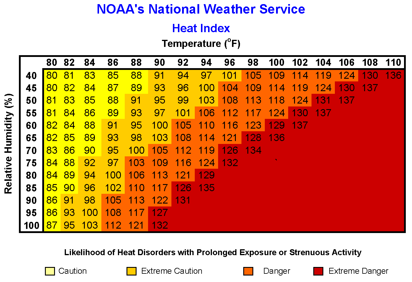
*As stated yesterday, THE HEAT IS DEFINITELY ON this week as a ridge if high pressure basically dominates the area. The Heat Index for our area today will be “around” 103. The Heat Index (HI) or the “Apparent Temperature” is an accurate measure of how hot it really feels when the Relative Humidity (RH) is factored in with the actual air temperature.
Keep in mind that your body sweats to help keep you cool. Many folks think that you shouldn’t sweat because it’s embarrassing. Just remember that the human body does what it does to help keep you alive and protect itself. That actually is better than the alternative. There are many articles out there and I will point some of those out in the coming days. Just be careful out there and PAY ATTENTION to how you feel in the heat.
* Overall, we’ll be ok so here is your forecast from the NWS/NORMAN;
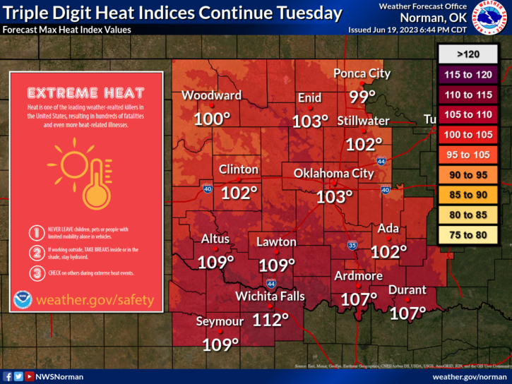
Today- Mostly sunny. Highs in the lower 90s. Southeast winds 10 to 15 mph with gusts up to 25 mph. Heat index values up to 105 this afternoon.
Tonight- Partly cloudy. Humid with lows in the lower 70s. East winds 10 to 15 mph.
* STAY COOL AND HAVE A GOOD DAY!