0255L-WEDNESDAY OUTLOOK FROM GARFIELD COUNTY EMERGENCY MANAGEMENT-6/21/23
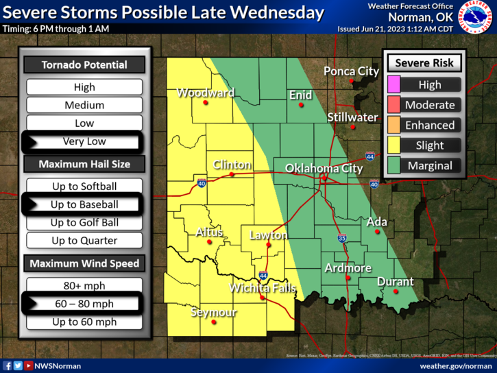
* We are in a MARGINAL risk for severe weather later today and tonight. IF STORMS OCCUR, high winds and hail will be the main threats. There is a 20% chance. This said, there is a chance we could see thunderstorms, this morning, in the area moving in from Kansas so we’ll keep an eye out there too. These storms appear that they would be high based storms and would pose a wind and hail threat IF they develop this far south. We’ll see what happens.
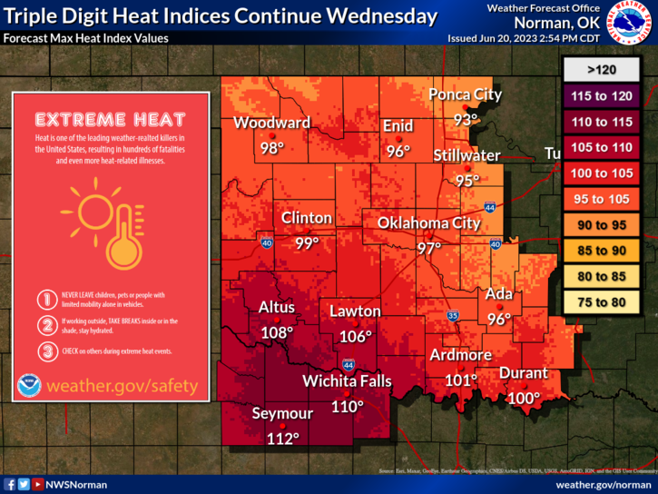
*Here is the link to the NWS website and a lot of heat related information: https://www.weather.gov/safety/heat
*Overall, we’ll be ok so here is your forecast from the NWS/NORMAN;
Wednesday- Mostly sunny with a slight chance of showers and thunderstorms. Humid with highs in the lower 90s. Southeast winds 10 to 15 mph with gusts up to 25 mph. Chance of rain 20 percent.
Wednesday Night- Partly cloudy. Lows in the upper 60s. East winds 10 to 15 mph with gusts up to 25 mph, becoming northeast around 5 mph after midnight.
Be sure to download our GARFIELD COUNTY EM app. Here is a link to our website for the links to the google play store and itunes: https://gcem.org/garfield-county-em/
HAVE A GOOD DAY!