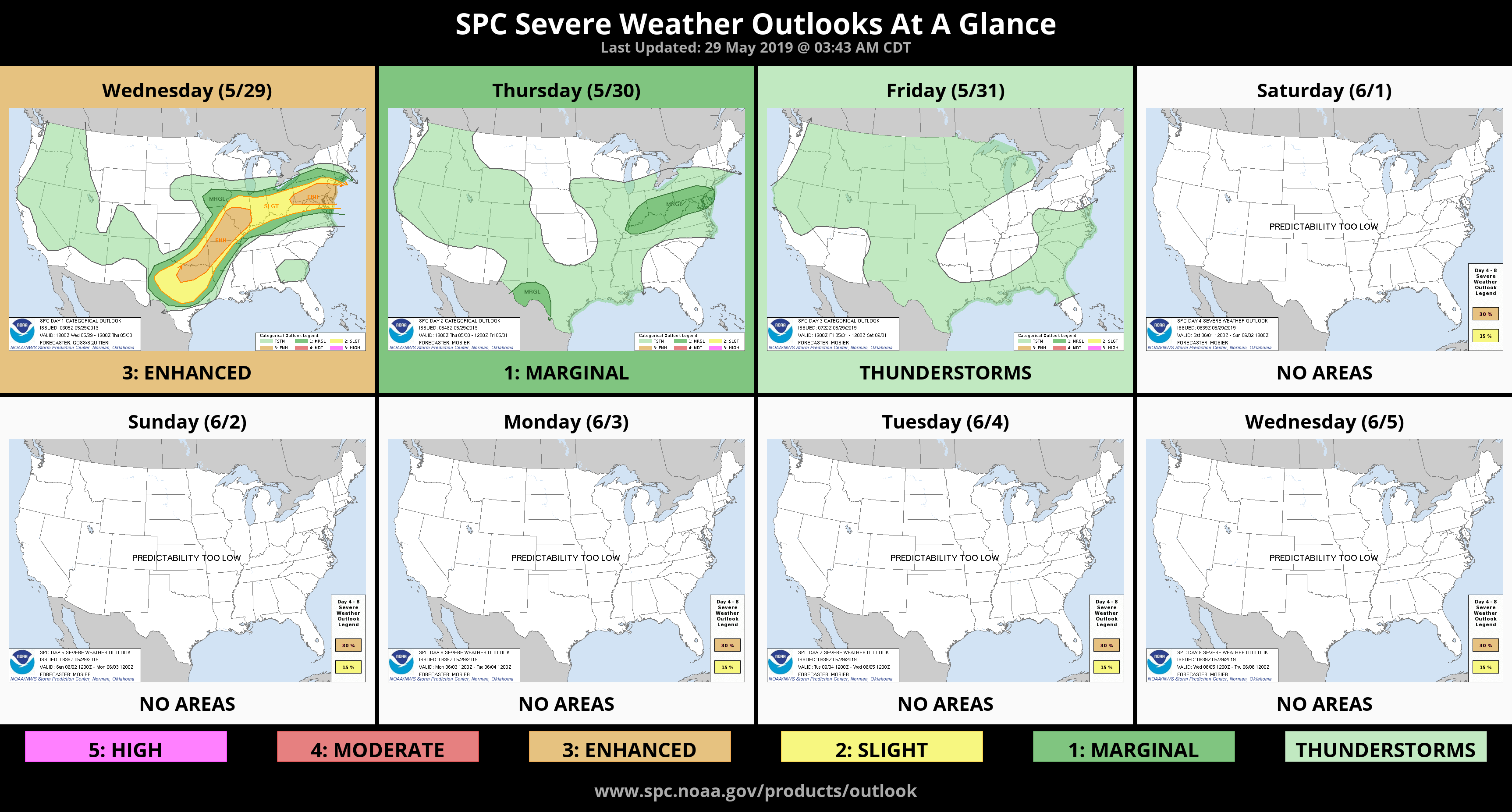
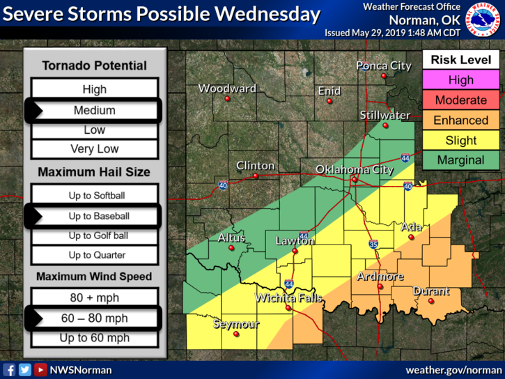
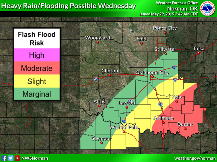
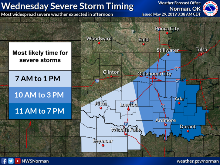
0440L-WEDNESDAY OUTLOOK FROM ENID/GARFIELD COUNTY EMERGENCY MANAGEMENT-5/29/19
1- We are in a GENERAL RISK for thunderstorms here today. The severe threat should be in southern and southeast Oklahoma. There are flood risks all around the state so if you plan on traveling, check for road conditions on our website- www.gcem.org and you can check on river conditions here- https://water.weather.gov/ahps2/index.php?wfo=oun
2- A WATCH means conditions are favorable for severe weather. A WARNING means that something is occurring now and to take the appropriate action. I just wanted to clear this up for some folks out there.
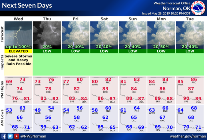
3- Overall, we may see some rainfall. We don’t expect anything severe so here is your forecast from the NWS/NORMAN;
Wednesday-40 percent chance of showers and thunderstorms, mainly after 1pm. Some of the storms could produce heavy rainfall. Mostly cloudy, with a high near 73. North wind 8 to 13 mph.
Wednesday Night-Mostly cloudy, then gradually becoming mostly clear, with a low around 52. North wind around 7 mph.
HAVE A GREAT DAY AND WE’LL KEEP AN EYE OUT
MIKE