0325L-TUESDAY OUTLOOK FROM GARFIELD COUNTY EMERGENCY MANAGEMENT-10/13/2020
1- GARFIELD COUNTY EM is our emergency notification app. If you don’t have it, you will need it. Download it, learn from it, and be prepared with it. PREPAREDNESS = RESILIENCE
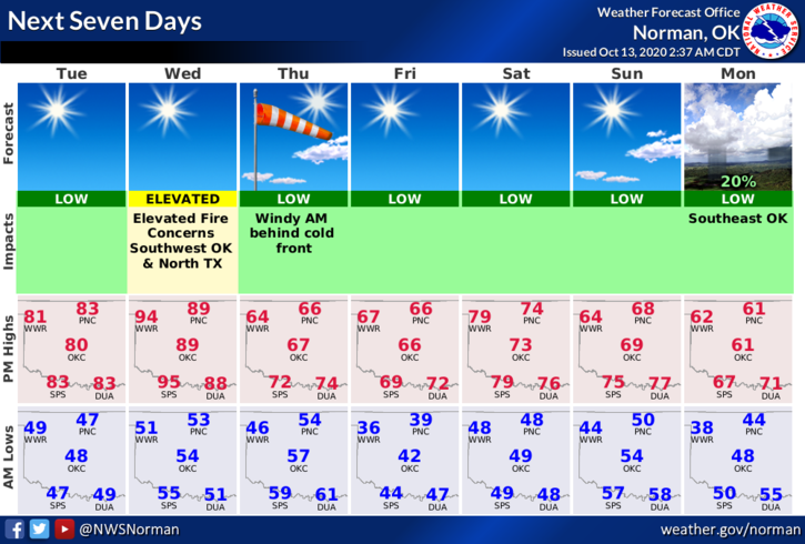
2- Today will be mild as south winds return to the area. On Wednesday, temps are expected to climb back into the low 90s and then Wednesday night another stronger cold front moves through and cools us off and we’ll remain cooler through the weekend. Welcome back to fall.
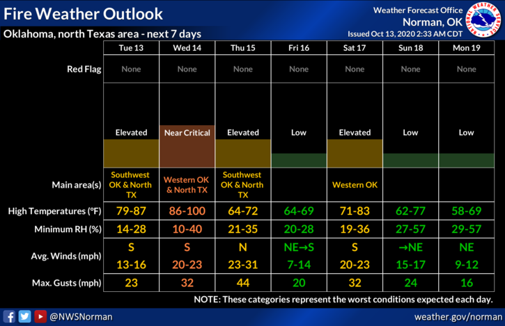
3- As I have been stating for quite some time, we are moving into a dangerous period where the FIRE DANGER is slowly increasing. Be extremely careful with anything related to fire and call 911 if see any smoke or fire.
4- Overall, we’ll be ok so enjoy the day. Here is your forecast from the NWS/NORMAN;
Today-Sunny. Highs in the lower 80s. South winds 10 to 15 mph with higher gusts.
Tonight-Clear. Lows in the lower 50s. South winds around 10 mph
HAVE A GOOD DAY!
MIKE