0400L-TUESDAY OUTLOOK FROM GARFIELD COUNTY EMERGENCY MANAGEMENT-9/1/2020
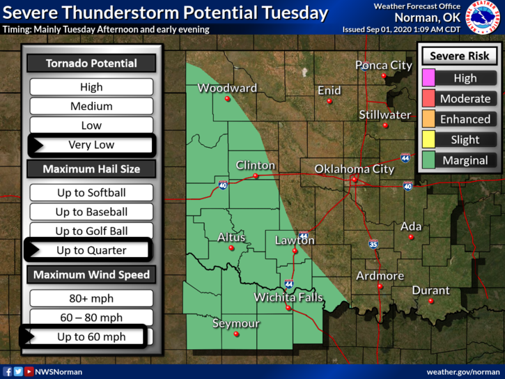
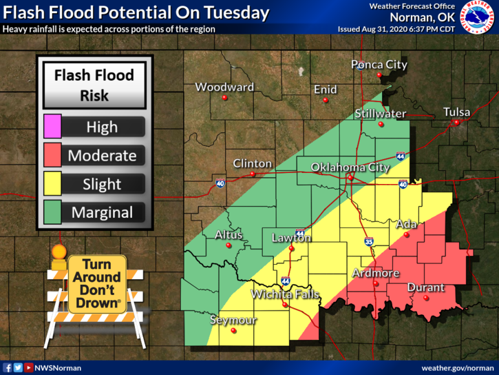
1- Cooler temps and a chance for thunderstorms. Higher chances will occur in southwest and southern Oklahoma so if you plan on traveling check out NWS information first. There are flood warnings in effect and another trough is impacting southern Oklahoma now. More will come later today and tonight.
2- Overall, we’ll be ok but heavy rainfall looks to remain to our south for today and possibly tonight. I’ll watch this and advise as needed. Here is your forecast from the NWS/NORMAN;
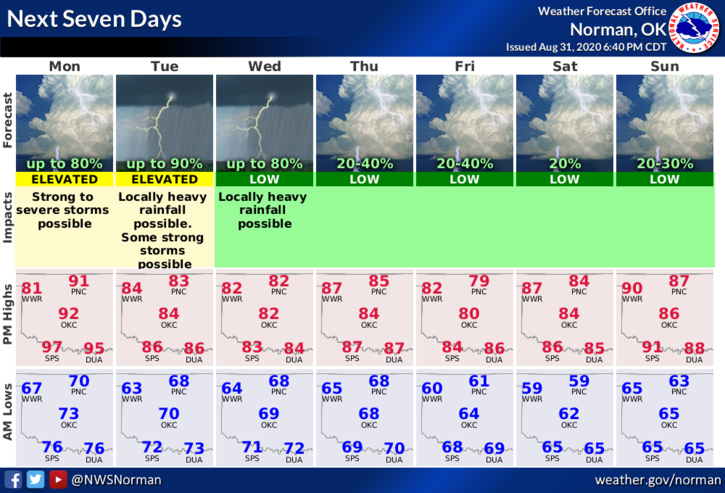
Today-Mostly cloudy. A chance of thunderstorms through late afternoon. Highs in the mid-80s. Light and variable winds becoming southeast around 10 mph in the afternoon. Chance of thunderstorms 60 percent.
Tonight-Mostly cloudy. Thunderstorms likely in the evening, then a chance of thunderstorms after midnight. Lows in the upper 60s. Light and variable winds. Chance of thunderstorms 60 percent.
HAVE A GOOD DAY!!
MIKE