0400L-WEDNESDAY OUTLOOK FROM ENID/GARFIELD COUNTY EMERGENCY MANAGEMENT-12/19/18
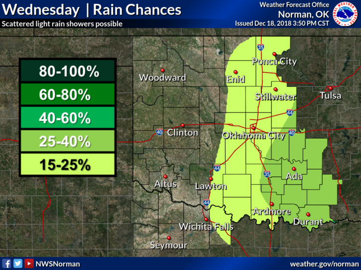
- Rain is possible but I am not holding my breath this afternoon. This storm system that is heading our way will blow through fairly quickly.
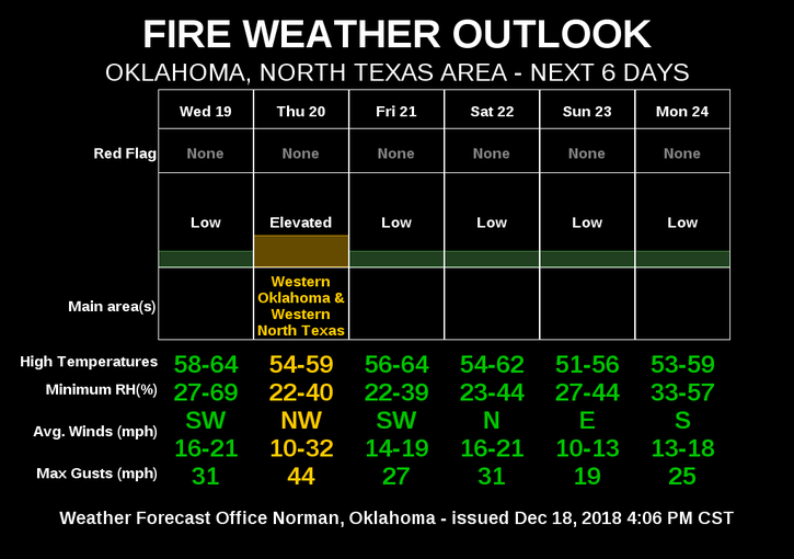
2- Winds will be relatively light today until a front pushes in later this afternoon. Winds will shift from the north and we start our higher wind timeframe. They will gradually get stronger on Thursday and there may be a few wind advisories around the area. We’ll see what the NWS does there.
3- When we have strong winds and low humidity, the FIRE DANGER INCREASES. Keep this in mind later today and tomorrow.
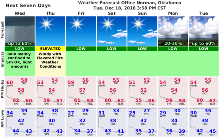
4- Here is your forecast from the NWS/NORMAN;
Today- Partly cloudy with possible patchy fog early in the morning, then mostly cloudy with a slight chance of rain showers in the afternoon. Highs in the upper 50s. Southwest winds around 10 mph shifting to the northwest in the afternoon. Chance of showers 20 percent.
Tonight- Partly cloudy. A slight chance of rain showers in the evening. Lows in the upper 30s. Northwest winds 10 to 15 mph. Chance of showers 20 percent.
HAVE A SUPER DAY!!
MIKE