0355L-WEDNESDAY OUTLOOK FROM GARFIELD COUNTY EMERGENCY MANAGEMENT-2/2/22
WINTER STORM WARNING IN EFFECT FROM NOW UNTIL THURSDAY AT 6PM
WIND CHILL ADVISORY IN EFFECT FROM TONIGHT AT 6PM UNTIL FRIDAY AT 12 NOON
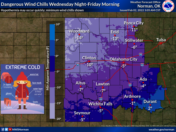
1- TEMPS will continue to fall as we move through the next few days. There is ICE on the ground so EXTREME CAUTION is advised. If you have to get out, drive slowly. WIND CHILL will not be our friend for several days so be careful concerning your time outside and especially with any exposed skin. Wind gusts over 35 mph are possible so again be very careful. Wind chill temps will reach zero by late afternoon today and remain below zero into Friday.
2- Make sure outdoor pets have plenty of water, shelter, and food. They get cold too.
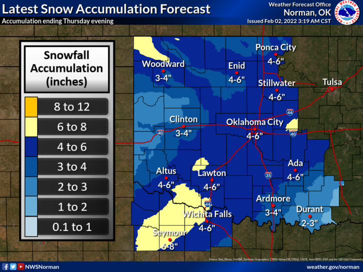
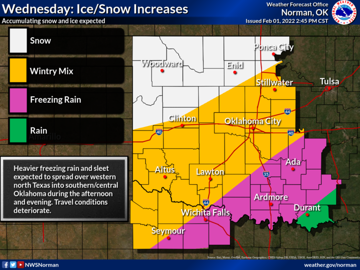
3- It will snow most of the time so keep this in mind. We are still on track for that 4-6 inches or more depending on heavier snow bands but we’ll see light to moderate snow, heavier at times during the day so just sit back and enjoy. On any graphic put out there, don’t get fixated on where lines are. THEY WILL BE SHIFTING AROUND as this system moves through.
4- OVERALL, we’ll be ok so stay in, if possible, and enjoy the cold. Just think, in a few months we’ll be miserable with humidity and skeeters flying around. Here is your forecast from the NWS/NORMAN;
Wednesday-Snow, mainly after noon. Patchy blowing snow after 3pm. Temperature falling to around 18 by noon. North northeast wind 18 to 22 mph, with gusts as high as 31 mph. Chance of precipitation is 90%. New snow accumulation of 1 to 3 inches possible.
Wednesday Night-Snow, mainly before midnight. Patchy blowing snow. Low around 6. Wind chill values as low as -10. North wind 18 to 20 mph, with gusts as high as 28 mph. Chance of precipitation is 80%. New snow accumulation of 2 to 4 inches possible.
STAY WARM AND STAY SAFE