0330L-WEDNESDAY OUTLOOK FROM GARFIELD COUNTY EMERGENCY MANAGEMENT-3/23/22
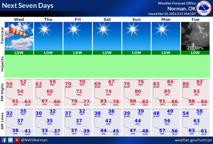
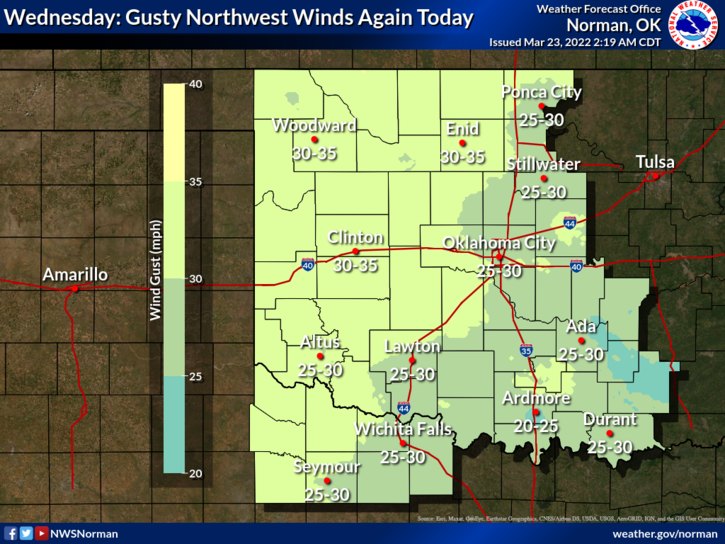
1- Rain and winds were the issues yesterday and it appears we will continue with the winds again today. Yesterday’s max wind gust was 46 mph. We may see some more rainfall later today, though light, as another disturbance pushes across the area. We expect another front Friday that shouldn’t have any major effect on us.
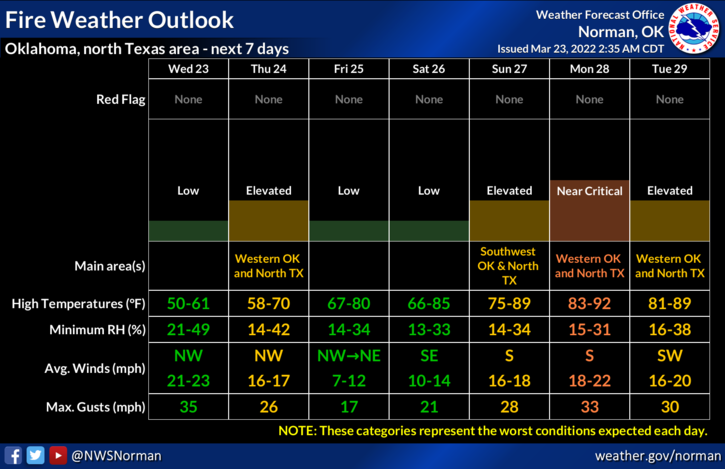
2- Sunshine will return after today for the rest of the week so we should see drying and mild winds. The Fire Danger will return as surface foliage dries out so continue to use caution utilizing anything related to fire.
3- For today, continue to use caution while driving due to gusty winds and possibly wet roads. Overall, we’ll be ok so enjoy the sunshine when it returns. Here is your forecast from the NWS/NORMAN;
Today-Sunny this morning, then becoming partly sunny. Breezy with highs in the lower 50s. Northwest winds 15 to 25 mph with gusts up to 35 mph.
Tonight-Mostly cloudy. Cold with lows in the lower 30s. Northwest winds 10 to 15 mph with gusts up to 25 mph, becoming west around 5 mph after midnight.
HAVE A GOOD DAY!