0310L-WEDNESDAY OUTLOOK FROM GARFIELD COUNTY EMERGENCY MANAGEMENT-9/28/22
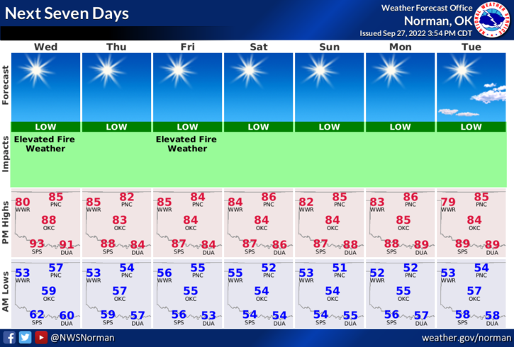
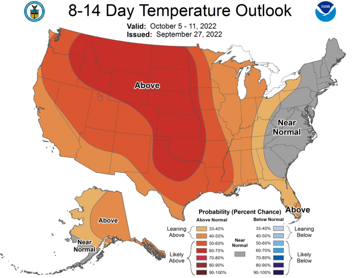
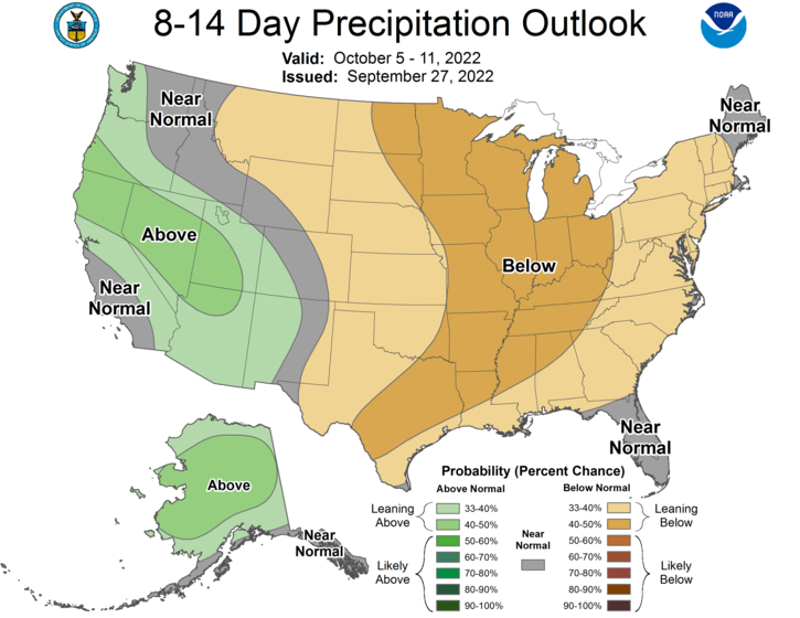
1- A weak cold front has pushed into the area. No significant cool down is expected but we’ll see high temps in and around the mid-80s. Looking at the graphics, low temps look like they will be in the 50’s this week. I have attached graphics pertaining to the temperature and rain outlooks for the next 8 to 14 days. It doesn’t look to good for the rain for sure.
2- Fire Weather for our area is still elevated but with lighter winds the spread component is lower. Any fire that gets going will spread quickly since fire creates it’s own weather and if it’s in dryer grasses. Hopefully nothing happens along that line. Use extreme caution while utilizing anything related to fire. Also, if you see smoke or fire, call 911 asap so the proper response can be sent.
3- PREPARE for winter. Get READY for winter. STOCK UP for winter. I know you think it’ll be a while before it gets here but if you aren’t prepared for it, you may be colder and hungrier than others. Here is a link to the NWS WINTER WEATHER RESOURCE list. Take the time to go through these. https://www.weather.gov/safety/winter
4- GARFIELD COUNTY EM is our notification app. I haven’t mentioned it in awhile but it is most likely going to be your good friend in emergency situations. It’s free and its loaded with a wealth of information. It just might be your first line of defense if all else fails in an emergency. Download it today. GARFIELD COUNTY EM in your app stores.
FINALLY, OVERALL, we’ll be ok so keep an eye out for suspicious activity.
HAVE A GOOD DAY!